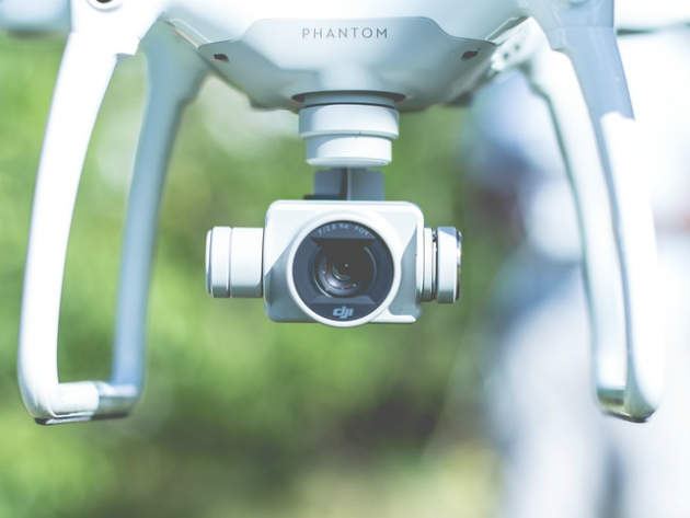
Drones are breaking ground on UK’s railways when it comes to accident investigation. Both Network Rail and the Rail Accident Investigation Branch have been using them over the past two years, while researchers at Cranfield University are testing the new generation of autonomous drones for enhanced methods of evidence collection.
Since their appearance on the consumer market, drones have proved to be incredibly versatile devices that save manpower, operational costs, and reduce many of the risks employees were previously exposed to.

Discover B2B Marketing That Performs
Combine business intelligence and editorial excellence to reach engaged professionals across 36 leading media platforms.
In June, a UK government consultation received a creative proposal to start using unmanned aerial vehicles (UAVs) above train carriages to improve WiFi connection and phone signal on board.
While such ideas are somewhat outlandish, when it comes to rail accident investigation, drones can deliver more accurate and detailed imagery of the site at a fraction of the cost of a helicopter.
They are currently fully operational on the network, from helping Network Rail in its inspection and survey of tracks, to investigation work undertaken by the Rail Accident Investigation Branch (RAIB).
Researchers from Cranfield University are also currently testing UAVs on accident sites, pushing the boundaries on 3D modelling, thermal and multi-spectral imagining for more accurate data collection.

US Tariffs are shifting - will you react or anticipate?
Don’t let policy changes catch you off guard. Stay proactive with real-time data and expert analysis.
By GlobalDataNetwork Rail’s surveys and a “Corridor for Drones”
Network Rail began using drones in its accident investigation operations in January 2014, following a serious landslide at Hatfield Colliery in South Yorkshire.
“The key advantage that we saw in terms of accident recovery was that, because the land was moving so slowly over a number of weeks, it was far more cost effective to send a drone up on a daily basis to provide information to enable people to measure how the land had moved,” says Wendy Welsh, head of air operations at Network Rail.
Currently, the infrastructure manager has four approved suppliers which provides it with drone services.
“We are using them for overhead line inspections and for major projects where we have a work site,” Welsh explains. “We use the imagery to create digital terrain models, digital surface models, doing volumetrics we can use to create very high 4k video for public consultations, and pictures for reports.”
Considering Network Rail currently covers over 25,000 miles of tracks, it is looking to expand its use of drones. Within the next six months, the operator is planning to send out an invitation to tender to increase the supply base and test the market for new UAV technology.
But some issues remain. Although all Network Rail drone inspections comply with the Data Protection Act, the potential of streaming live information to the control centre will call for data encryption measures.
“If we wanted to increase the use of drones following an incident, […] that’s when we will have to start thinking about making sure that the data is encrypted and cannot be intercepted by unauthorised users,” Welsh says.
Another operational challenge would be providing a “safe highway” for beyond visual line of sight drone operations, so as not to risk interception with helicopters, an idea Welsh refers to as a “corridor for drones”.
“One of the restrictions that we have currently is the requirement to operate within the line of sight,” she says. “So for inspecting linear infrastructure, that gives us lots of limitations. But if we could fly beyond visual line of sight and autonomously operate a number of drones, I think the railway line potentially provides that safe corridor if we had the right airspace management system, the right communications and the power.”
RAIB’s aerial investigations
The Rail Accident Investigation Branch (RAIB) is a government agency who works with the Department for Transport to independently investigate and find a cause for rail accidents.
RAIB started using drones in 2015, after borrowing one from its sister branch, the Air Accidents Investigation Branch (AAIB). Currently, the RAIB has two drones, one at each of its bases in Farnborough and Derby, and they have been used at eight accident sites over the last two years.
“We can use a drone to obtain high quality aerial images from sites which in the past would have required a helicopter, the cost of which cannot be financially justified for most accident sites we go to,” says RAIB inspector Simon Kay.
“So whereas in the past we would have been reliant [on] asking other bodies to send up a helicopter, which would have significant cost implication for them, we can now obtain our own images as and when we want, at minimal cost. This gives us much more operational flexibility on site.
“The small size of the drones enables us to obtain images and video from heights and angles we would not otherwise be able to get, even with a helicopter, because the area around an accident site is often restricted by trees and overhead wires,” Kay says.
The branch is also looking at expanding on their current drone use, with plans to train two more staff members, as well as undertake trials of using the drones for surveying purposes. RAIB intends to use new technology that enables a three dimensional photographic model of an accident site to be created.
“This would offer us the ability to overlay images on a topographical map and to take accurate measurements back in the office,” Kay explains. “We see this as an opportunity to help us gather site evidence more efficiently and release sites back sooner, to restore normal railway services.”
Advanced evidence collection at Cranfield University
Researchers at Cranfield University have also been exploring the role of drones in accident investigations for the past two years, using Commercial Off The Shelf (COTS) drone technologies such as DJI Phantom or Inspire, which are available to the public.
“Firstly, we send the drones forward to do a complete risk assessment of the accident site, because by their nature, accident sites can be very dangerous for people to operate in,” says Pete McCarthy, lecturer in Human Factors and Accident Investigation at Cranfield University.
“We collect that evidence using normal, thermal and multispectral cameras, and once we’ve got that, we use that imagery to create a 3D model of the accident. So even when the accident is cleared away, the investigators now have a 3D model that they now can reference for their investigation.”
McCarthy admits that current regulation is still restricting the full potential of drones, but he anticipates that soon enough, operators will be able to operate beyond line of sight.
“As we go further down the line, we try to develop new and innovative techniques using drones and accident sites,” he says.
“We are looking closely at enhanced methods of evidence collection using drones, so sampling and thermal and multispectral and also looking at higher levels of autonomy for the drone on the accident site.”


